|
|
Monitor-Merrimac Memorial Bridge-Tunnel (MMMBT) is the 4.6 mile-long (7.4 km) Hampton Roads crossing for Interstate 664. It is a four-lane bridge-tunnel comprised of bridges, trestles, man-made islands, and tunnels under a portion of the Hampton Roads harbor where the James, Nansemond, and Elizabeth Rivers come together in South Hampton Roads, in the southeastern portion of Virginia in the United States.
It connects the independent cities of Newport News on the Virginia Peninsula and Suffolk in South Hampton Roads and is part of the Hampton Roads Beltway |
Interstate 664 is the 20.7-mile-long freeway that connects I-64 in Hampton to I-64/I-264 in Chesapeake, completed in April 1992. I-664 includes the 4.6-mile Monitor-Merrimac Memorial Bridge-Tunnel (MMMBT). The MMMBT cost $400 million to build, and it includes a four-lane tunnel that is 4,800 feet long, two man-made portal islands, and 3.2 miles of twin trestle. Northbound on the MMMBT is one of the most spectacular views on any road I know of; Hampton Roads makes a "V" with one branch to your ten o'clock, and the other branch to your two o'clock. You see an enormous expanse of water, left, right, and ahead of you, with the landfall of the Peninsula dead ahead. On the ten o'clock branch, you see the Newport News Marine Terminal and Shipyards, on the two o'clock branch, you see the Norfolk Naval Base. Typically, you will see a couple Nimitz-class aircraft carriers moored in the distance, and many other ships. Another nice feature, is that the MMMBT is toll-free. The name comes from the fact that the duel between the two Civil War ironclads was fought less than a mile from the where the tunnel is today.
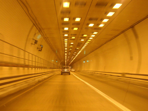
The tunnel is 4,800 feet long from portal to portal, and it was built by the immersed sunken tube method, comprised of 15 prefabricated segments each 300 feet long and with two 2-lane bores, placed by lay-barges and joined together in a trench dredged in the bottom of the harbor, and backfilled over with earth. Four percent (4%) maximum grades are utilized in the tunnel, and a 60 mph design speed. The traffic lanes in the tunnel are 13 feet wide, with 2.5-foot-wide ledges on either side of the roadway, and with 16.5 feet of vertical clearance from the roadway to the ceiling. The current shipping channel above the deepest part of the tunnel, has 800 feet of horizontal width and 45 feet of vertical depth below the average low-tide water level; and the tunnel was designed and built deep enough to allow for a future enlargement of the shipping channel to 1,000 feet of horizontal width and 55 feet of vertical depth below the average low-tide water level.
|

